
La Boca Fm
Type Locality and Naming
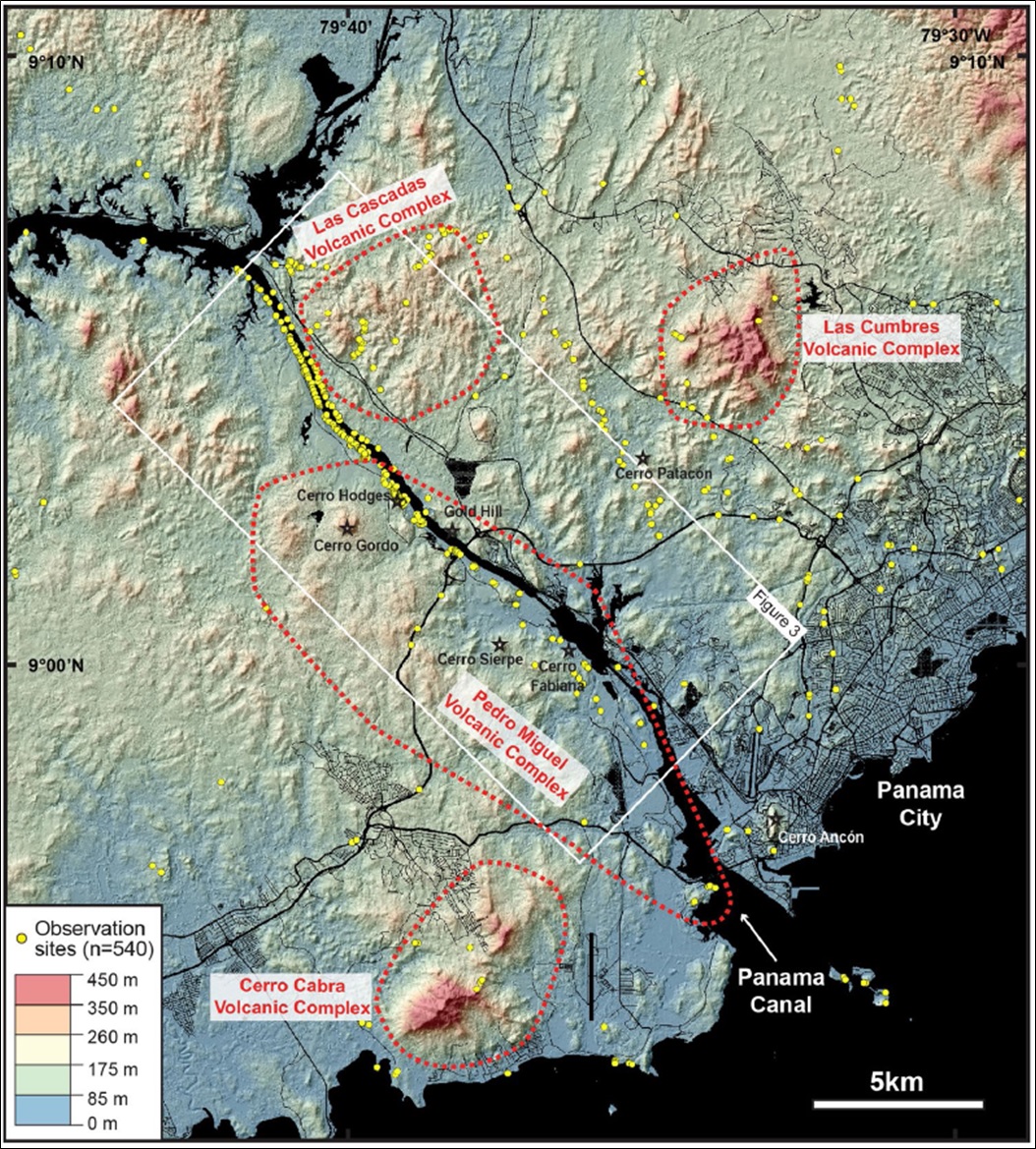
[Figure 1. Topography of the Central Panama in the southern Panama Canal area and its main volcanic complexes (Buchs et al. (2019)). Digital topography model based on Lidar survey by the Panama Canal Authority. The geological details of the area within the white rectangle (figure 3 of Buchs et al. (2019)) can be seen in Figure 4.]
Synonym: Not to confuse with the other, now obsolete, “La Boca Fm”
Lithology and Thickness
However, what has been previously mapped (Stewart et al. (1980)) as La Boca Fm near the mouth of the Panama Canal is lithologically different than the rocks Kirby et al. (2008) reassigned. The Culebra Fm in the central part of the Culebra Cut is composed of dirty grey marine sandstones with interbeds of limestone, whereas near the Pacific mouth of the Panama Canal, dacitic plugs intrude into bedded tuffs and volcani-clastic sedimentary rocks. Therefore, the stratigraphic tie from rocks in the central Culebra Cut to the mouth of the Canal is not particularly strong. Buchs et al. (2019).
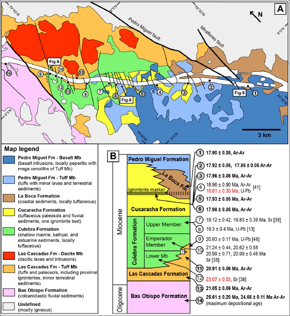
The Cucaracha Fm in the central part of the Culebra Cut likely extends laterally to the south (Pacific locks area) to layered sequences of tuffaceous sandstone with planar bedding to conglomerate. Marine shells and larger benthic foraminifera locally occur in the coarser sandstone and conglomerate. Significantly, a unique 17.90 ± 0.08 Ar-Ar Ma age for a brown intermediate (?) tuff from this unit indicates at least partly synchronous deposition with the Cucaracha Fm. Therefore, this unit is interpreted to represent the La Boca Fm, as originally recognised by canal geologists (Woodring (1955); Stewart et al. (1980)) based on cores from this area. Buchs et al. (2019)
Thickness: Unknown
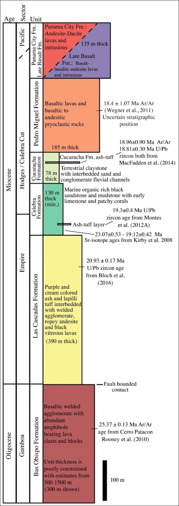
[Figure 2. Stratigraphic column of volcanic and sedimentary rocks exposed along the southern Panama Canal. Depicted total thickness of section is 1218 m. Section from Farris et al. (2017).]
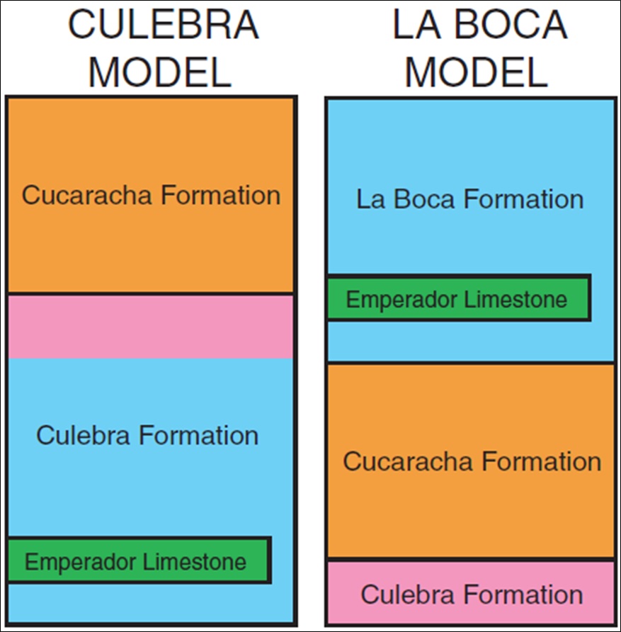
[Figure 3. The two alternative stratigraphic models for the formations exposed along the Culebra Cut portion of the Panama Canal; the Culebra model (left) and the La Boca model (right). Equal color between the two models refer to the same stratigraphic unit. Kirby et al. (2008) confirm that the Culebra Model is the valid one and interpret the rock interval known as La Boca Fm in the Culebra Cut to be the lower part of the Culebra Fm. However, he does not go as far as naming this Lower Member the “La Boca Member” of the Culebra Fm.]
Relationships and Distribution
Lower contact
Upper contact
[Figure 4. Geology of the southern part of the Panama Canal (Culebra Cut and new Pacific locks area). (A) Revised geological map. (B) Revised chronostratigraphic chart with previous and new geochronological constraints (new data in dark circles and bold text) (Buchs et al. (2019)). See location of the area in Figure 1.]
Regional extent
GeoJSON
Fossils
Age
Depositional setting
Additional Information
References: Woodring (1955); Stewart et al. (1980); Smith (1991); Farris et al. (2017); Buchs et al. (2019);